The Monistrol-d'Allier to Saugues section of the GR65 is 12 to 13.5 km (7.5 to 8.4 miles) depending on the source, and takes 3.5 to 5 hours. It starts with the big challenge of the day: roughly 400 to 500 m of almost continuous climbing over the first 4 to 6 km, from Monistrol (around 610 m) up to Montaure (1,022 m), past the Madeleine chapel. After that the path runs across the Margeride plateau at around 1,050 to 1,100 m before dropping into Saugues (960 m).
The second half of the Saint-Privat to Saugues stage
Most guidebooks do not treat this as a stage of its own: it is the second half of the Saint-Privat-d'Allier to Saugues stage, 19.9 km, +803 m / −703 m, 5 h 05 according to the official Haute-Loire route sheet (low point 591 m, high point 1,103 m). Monistrol, at the bottom of the gorge, splits that day in two: downhill in the morning, uphill afterwards. If you are coming from Saint-Privat, the first half is covered in our guide to Saint-Privat-d'Allier to Monistrol-d'Allier.
Sleeping in Monistrol and doing the climb first thing, while it is cool, is the most comfortable way to tackle it. Organised walking holidays that split the stage count 12 km for this Monistrol to Saugues leg.
Published elevation figures vary widely. The Visorando GPS track gives 611 m in Monistrol and 1,018 m at Montaure, so +407 m in 4.55 km. Gronze speaks of a climb of about 500 m, Wise Pilgrim of 380 m over 6 km. Over the whole section, one GPS track shows roughly +600 m and −250 m. Podiensis notes several pitches of more than 12% in the first four kilometres, then a final descent of around −13% just before Saugues.
The route, step by step
- Monistrol-d'Allier km 0 · ≈ 610 m Cross the Allier on the metal bridge, go up the street on the left, then take the road to the right. A lane drops towards a mill: you cross the Ance du Sud, then follow a path, the viewpoint car park, a track and a road.
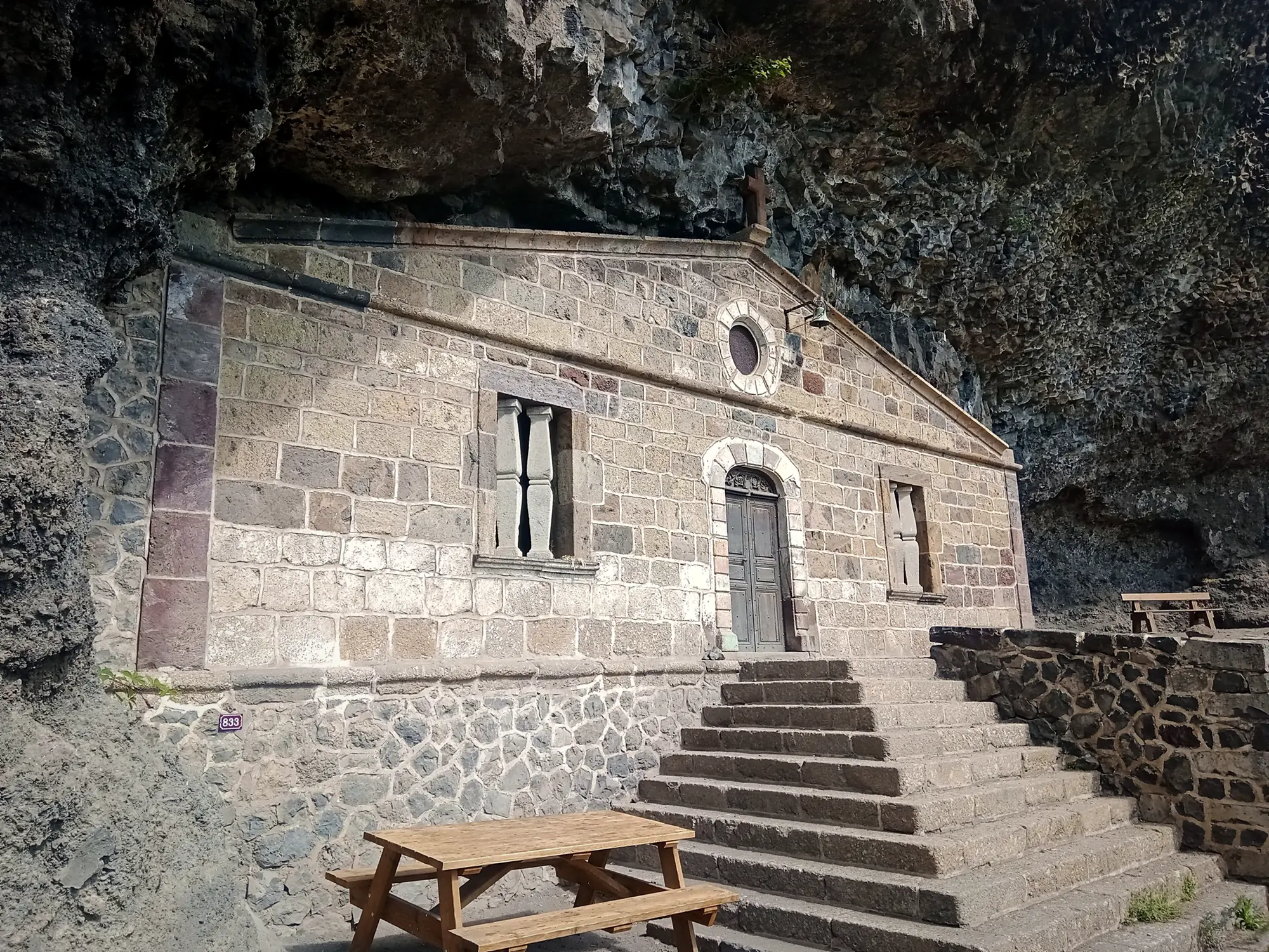
- Madeleine chapel km 1.5 · 721 m The cave chapel, tucked into the cliff. Just after it, the GR climbs a steep slope fitted with a handrail up to the rise at Escluzels.
- Escluzels Take the lane on the right; there is a horse trough on the way. Head north-west, and 800 m further on cross the road to La Valette.
- D589 km 2.6 · ≈ 830 m Cross the road and climb in switchbacks through the woods.
- Montaure km 4.5 · 1,022 m End of the big climb at the edge of the hamlet. Turn left along the road for 400 m, then take a dirt track due south.
- Roziers km 6.3 · ≈ 1,053 m In the village, the road passes a fountain. Junction of tracks at 1,069 m, north-west of the Garde hill.
- Le Vernet km 7.8 to 8.1 · 1,050 m The GR climbs the road to the fountain by the maison d'Assemblée (old village meeting house). The hamlet's refreshment stand has been reported closed since January 2025 (check locally).
- Rognac km 10 · ≈ 1,082 m A path along a fence, under a power line, then through the hamlet. The high point of the plateau, around 1,100 m, is in this area.
- D589 A track towards a pylon, then you cross the main road one last time. The official route sheet underlines it: "prudence!" (take care).
- Saugues km 12 to 13.5 · 960 m A fairly steep final descent into town.
Kilometre points are approximate, calculated from the Visorando track starting at the Monistrol bridge; Wise Pilgrim counts 7.8 km to Le Vernet, then 4.7 km to Saugues.
The Madeleine chapel, between rock and sky
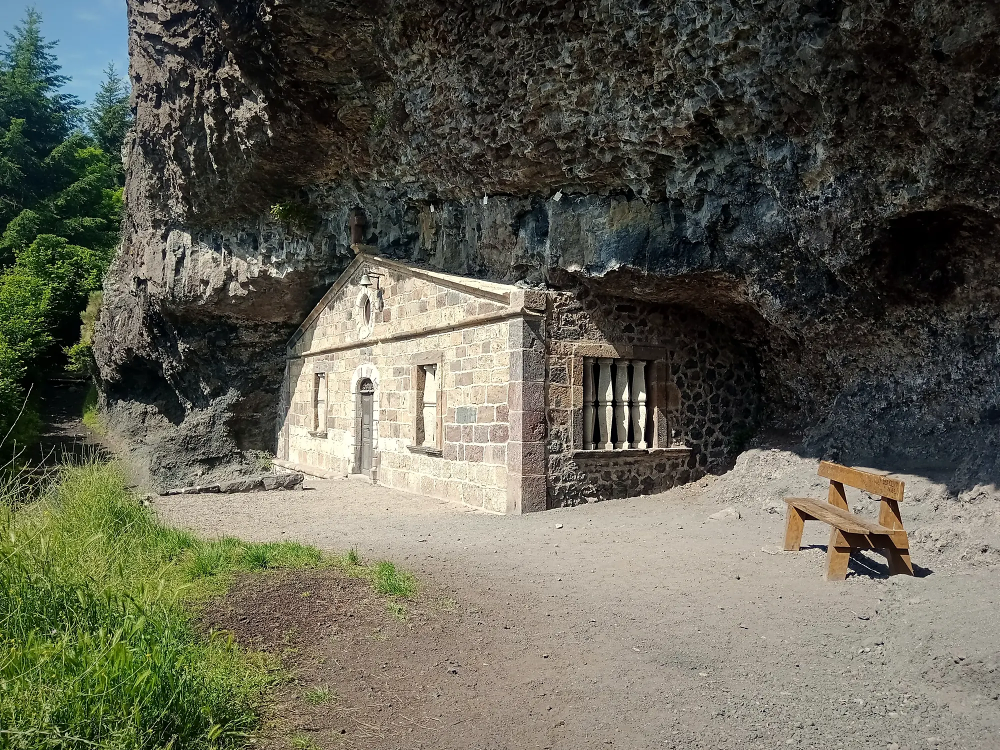
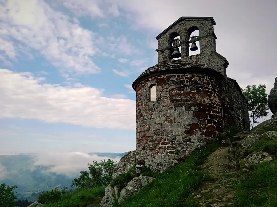
A little over a kilometre and a half from the bridge, the Sainte-Madeleine chapel appears in the rock face: a cave closed off by a stone facade topped with a pediment. The Haute-Loire route sheet dates it to the 17th century, while the historic monuments record links the style of the facade to the second half of the 18th. A treaty of 1312 is said to mention the cave being in use since the 12th century, and nearby graves were excavated in 1872-1873. It belongs to the commune and has been a listed monument since 10 October 2005. The path also runs past an old quarry of basalt columns: look at the rock around you.
It is a good spot to catch your breath for a minute, because what follows is the steepest part of the day.
How to prepare for the climb out of Monistrol
The climb out of Monistrol has a reputation: Wise Pilgrim ranks it among the toughest on the whole Via Podiensis. The official route sheet talks of a "forte pente" (steep slope) with a handrail. Nothing insurmountable, but a few habits make all the difference.
Start early. The slope is exposed, and the heat in the gorge builds quickly in summer. Set off between 7 and 8 a.m. and you climb in the cool and reach the plateau before the worst of the sun. Eat first: a 400 to 500 m climb on an empty stomach is a sure way to hit the wall at Montaure. At L'Auberge des Amis, the walker's breakfast (€9) is served from 6:30 a.m., and you can order a packed lunch to take away (€14) the evening before, for a picnic on the plateau.
- Fill your bottles in Monistrol, at least 1.5 to 2 litres. There are no confirmed shops until Saugues.
- Climb slowly, at a pace where you can still talk. Poles help on the way up too, and the handrail is there to be used.
- In wet weather volcanic rock is slippery: take care on the section after the chapel.
- At both crossings of the D589, look carefully: traffic is fast.
These tips come from experience on the ground, not from official guidance.
Where to fill your water bottle between Monistrol and Saugues
The official route sheet lists three water points: the horse trough at Escluzels, the fountain at Roziers and the fountain at Le Vernet, by the maison d'Assemblée. One online guide also mentions dry toilets. Otherwise, Wise Pilgrim is clear: no services between Monistrol and Saugues. The refreshment stand at Le Vernet, long popular with pilgrims, was reported closed since January 2025 by a walker: worth checking on the day, but do not count on it. Bring a picnic, or order a packed lunch the evening before.
Across the Margeride plateau
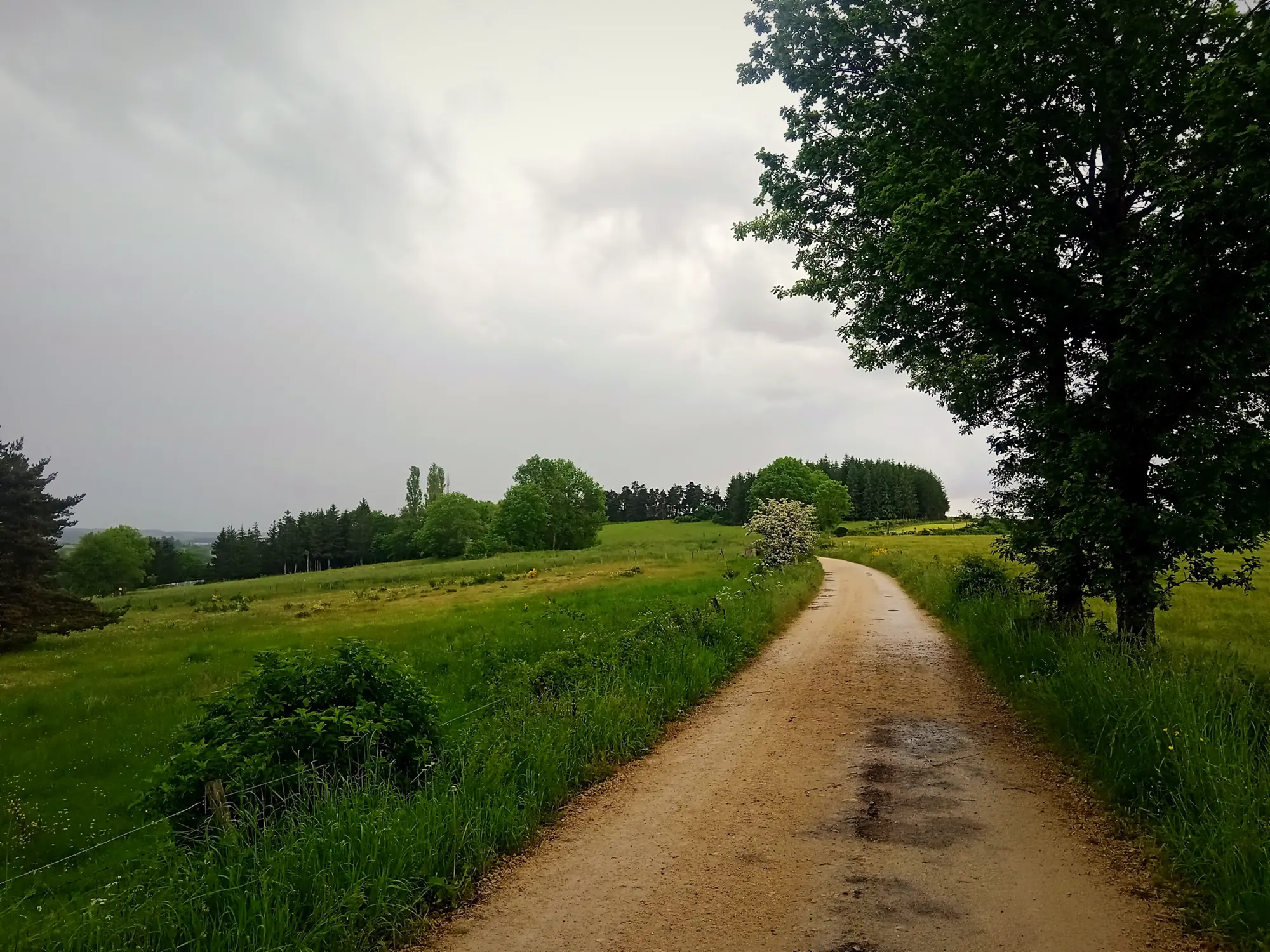
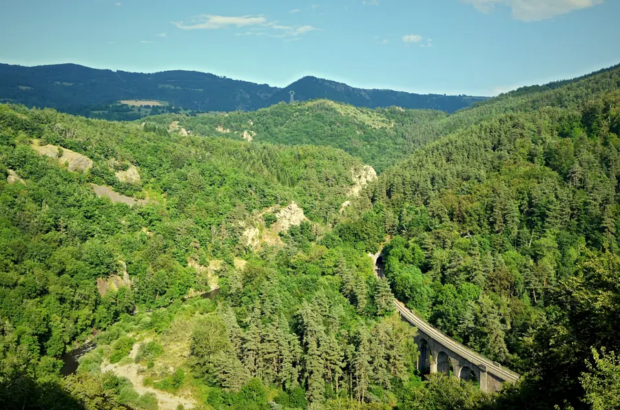
Beyond Montaure the landscape changes completely. After the narrow, wooded gorge you walk across an open plateau, from hamlet to hamlet, at around 1,050 m. This is where you recover: the route alternates between quiet lanes and dirt tracks, with no real difficulty until Rognac. The final descent to Saugues is short but fairly steep, around −13% for a few hundred metres.
Arriving in Saugues: services and the Beast of Gévaudan
Saugues is the first real small town since Le Puy, and it has what Monistrol lacks:
- ATMs: Crédit Agricole and Caisse d'Épargne, the first cash machines on the route since Le Puy.
- Pharmacy: the first on the GR65 since Le Puy.
- Pilgrim welcome at the collegiate church, 5 to 6:30 p.m., April to mid-October.
- Market on Friday mornings.
- Bus H04 Saugues to Monistrol and Le Puy-en-Velay, if you need to go back.
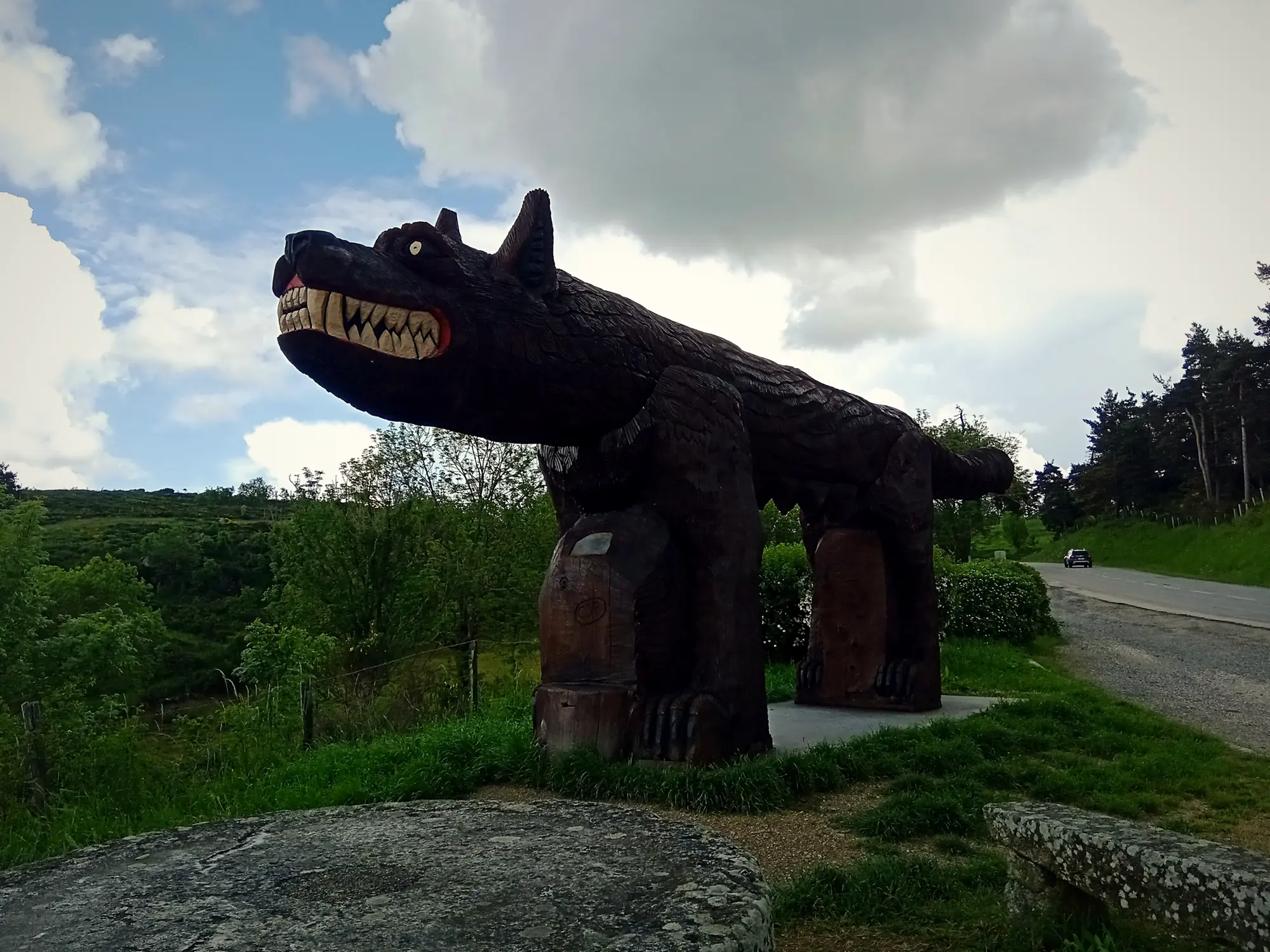
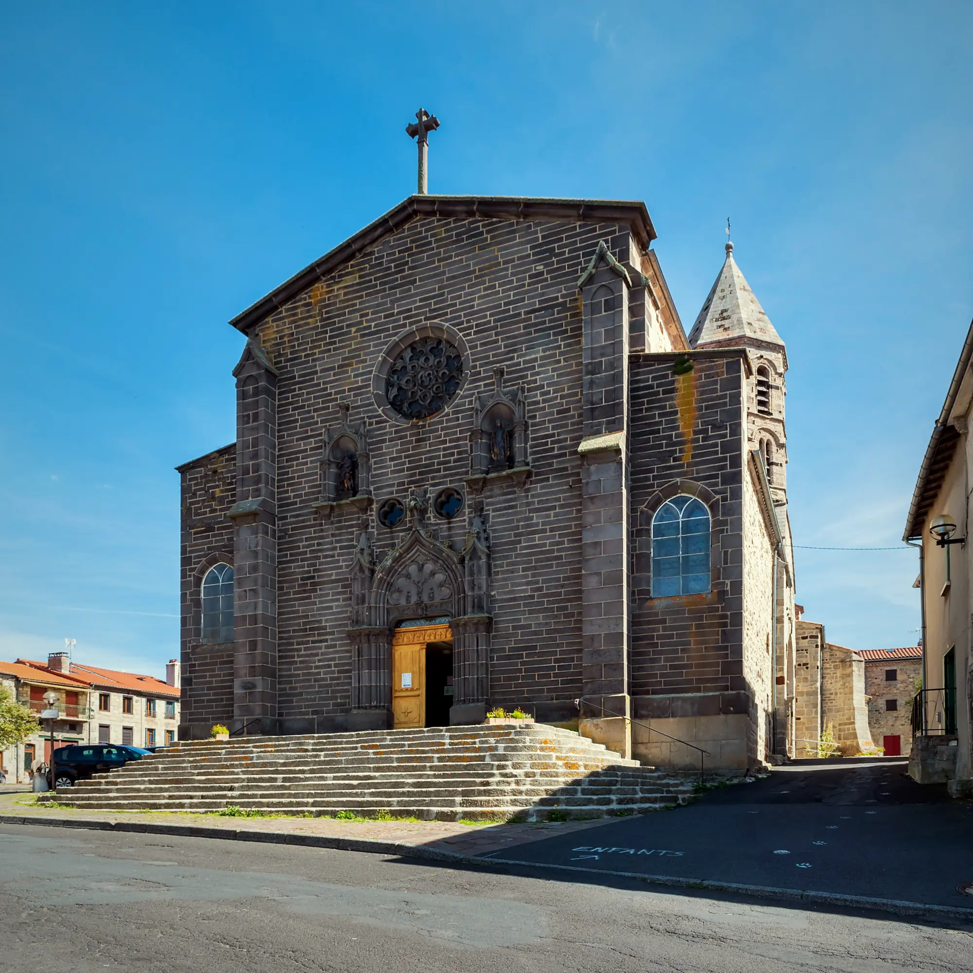
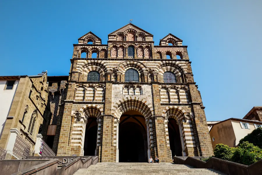
Worth seeing: the collegiate church of Saint-Médard, the Tour des Anglais (23 m) and the Beast of Gévaudan museum. The Beast first appeared in the summer of 1764 around Saugues; it was killed by Jean Chastel in June 1767, near Auvers. There is a link with today's walk: the statue of Notre-Dame d'Estours, carried in procession in 1767 to plead for protection from the Beast, now stands in the church at Monistrol-d'Allier. If you have not seen it yet, it is a good reason to take a short wander before you set off in the morning.
Before you leave: three reminders
Remember to get your credential stamped in Monistrol, at the town hall or at the auberge: it is all explained in our guide to the pilgrim credential on the Le Puy route. If your legs are asking for a break, the gorge has enough to fill a day without walking: rafting, canoeing, via ferrata (see things to do in the Allier gorges). And for a hearty dinner the night before the climb, the auberge's menu is here, with bookings on +33 6 01 86 25 44 or online.
Frequently asked questions
How long does it take from Monistrol-d'Allier to Saugues?
Allow 3.5 to 5 hours for 12 to 13.5 km, depending on your pace and breaks. The first hour and a half is the slowest part: the climb to Montaure.
Is the climb out of Monistrol hard?
Yes, it is one of the steepest on the early GR65. You gain roughly 400 to 500 m over the first 4 to 6 km, with pitches of more than 12% and a section fitted with a handrail after the Madeleine chapel. Start early, go slowly and it is perfectly manageable.
Is there water between Monistrol-d'Allier and Saugues?
The official route sheet lists a horse trough in Escluzels, a fountain in Roziers and a fountain in Le Vernet. There are no confirmed shops or cafés: the refreshment stand in Le Vernet has been reported closed since January 2025. Carry at least 1.5 to 2 litres.
Where can I get cash on the GR65 after Le Puy?
There is no ATM in Monistrol-d'Allier. The first ones on the route are in Saugues, at Crédit Agricole and Caisse d'Épargne. Saugues also has a pharmacy.
Can you walk Saint-Privat to Saugues in one day?
Yes: it is the classic stage, 19.9 km, +803 m / −703 m and 5 h 05 according to the official Haute-Loire route sheet. Monistrol is halfway; many walkers stop there for lunch, others stay overnight to do the climb in the cool the next morning.
Photo credits — Chapelle Sainte-Madeleine (Monistrol-d'Allier) © Rémih, CC BY-SA 4.0 (Wikimedia Commons) · Chapelle Sainte-Madeleine (Monistrol-d'Allier) © Rémih, CC BY-SA 4.0 (Wikimedia Commons) · Saugues © Rémih, CC BY-SA 4.0 (Wikimedia Commons) · Saugues © Tournasol7, CC BY-SA 4.0 (Wikimedia Commons) · GR65 trail Haute-Loire / Margeride © Rémih, CC BY-SA 4.0 (Wikimedia Commons)